If you’re visiting Kuala Lumpur and have decided to take the city trains as your transport option, this is the perfect guide for you to navigate the Kuala Lumpur train map and lines.
Quick links
How to plan your journey
Here are the two ways you can plan your journey when you want to get from point A to point B:
Integrated Transit Map
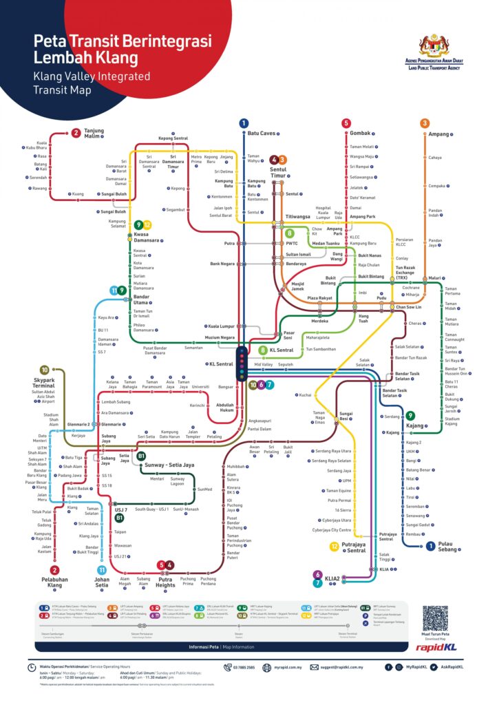
If you already know which station you’re at (Point A) and want to make a quick decision on how to get to your desired station (Point B), you will be able to trace that from the map above.
However, if your stations are on different colored lines, you’ll need to note if the line change is an “interchange station” – which means you don’t have to tap out while you make your switch – or if the line change is by a “connecting station”, in which you have to tap out to start a new ride in the new line. Here’s how you can identify that:
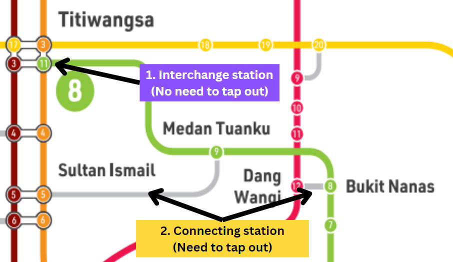
In scenario 1 (Purple box), you can see the No. 3 brown and No. 11 green stations are connected by a tube. That means you won’t have to tap out to go from brown line to green line (or vice versa) as it’s an “interchange station”. You will remain in the “Titiwangsa” station throughout.
In scenario 2 (Yellow box), you can see the No. 5 orange and No. 9 green stations are connected by a grey line. That means you will have to tap out to go from one station to the other as it’s a “connected station”. You will be going to a different station name, such as from “Medan Tuanku” to “Sultan Ismail”.
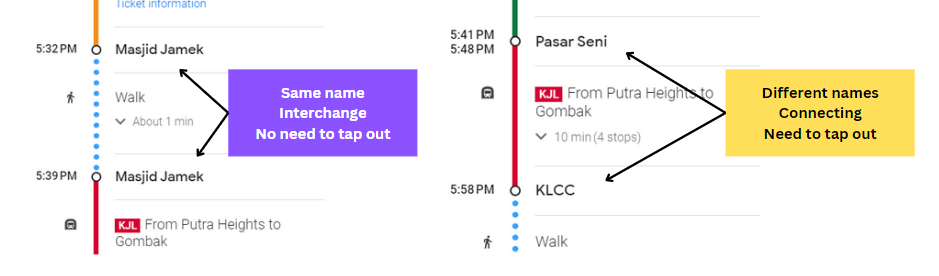
Using Google Maps
By selecting your departure and arrival destinations, and selecting the train option – Google Maps will show you which stations to head to, and which to get off of.
While there is no visual indicator of whether the line change is by a interchange or connected station, you can tell by if the station’s name changes. If it’s the same name, then it is an “interchange station”. If it’s a different name, then it is a “connecting station”.
What to look out for when you’re in the stations
Here are some things to look out for to ensure a safe and hassle free journey.
Getting to the right line
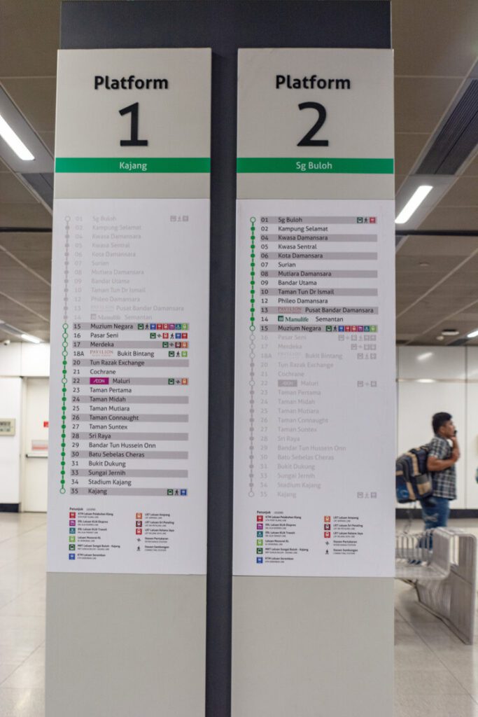
Some busy stations such as KL Sentral have multiple lines. Make sure you get to the right line by identifying the name, color, and symbol of the line, then matching it with the signboards at the station.
Identify the direction your train is going to
As we all know there are two ends to a train line, making sure you get in the train that’s going in the right direction is crucial.
The name of the direction goes by the final station of where the train is headed towards.
You can identify the right platform by looking at the sample signages in the station. With the example below, it is either towards “Kajang” or “Sg Buloh”.
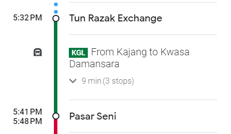
Or if you’re more tech-savvy, Google Maps automatically tells you which direction to head to in the journey details – To the direction of Kwasa Damansara.
Some platforms may have trains going in different directions, so you can make your final confirmation by either looking at the electronic sign board of the arriving train, or the front of the train where the direction is spelled out.
I hope you found this article helpful in navigating the Kuala Lumpur train system.